Satellite-Derived Bathymetry: An Assessment of Empirical Methods
Abstract
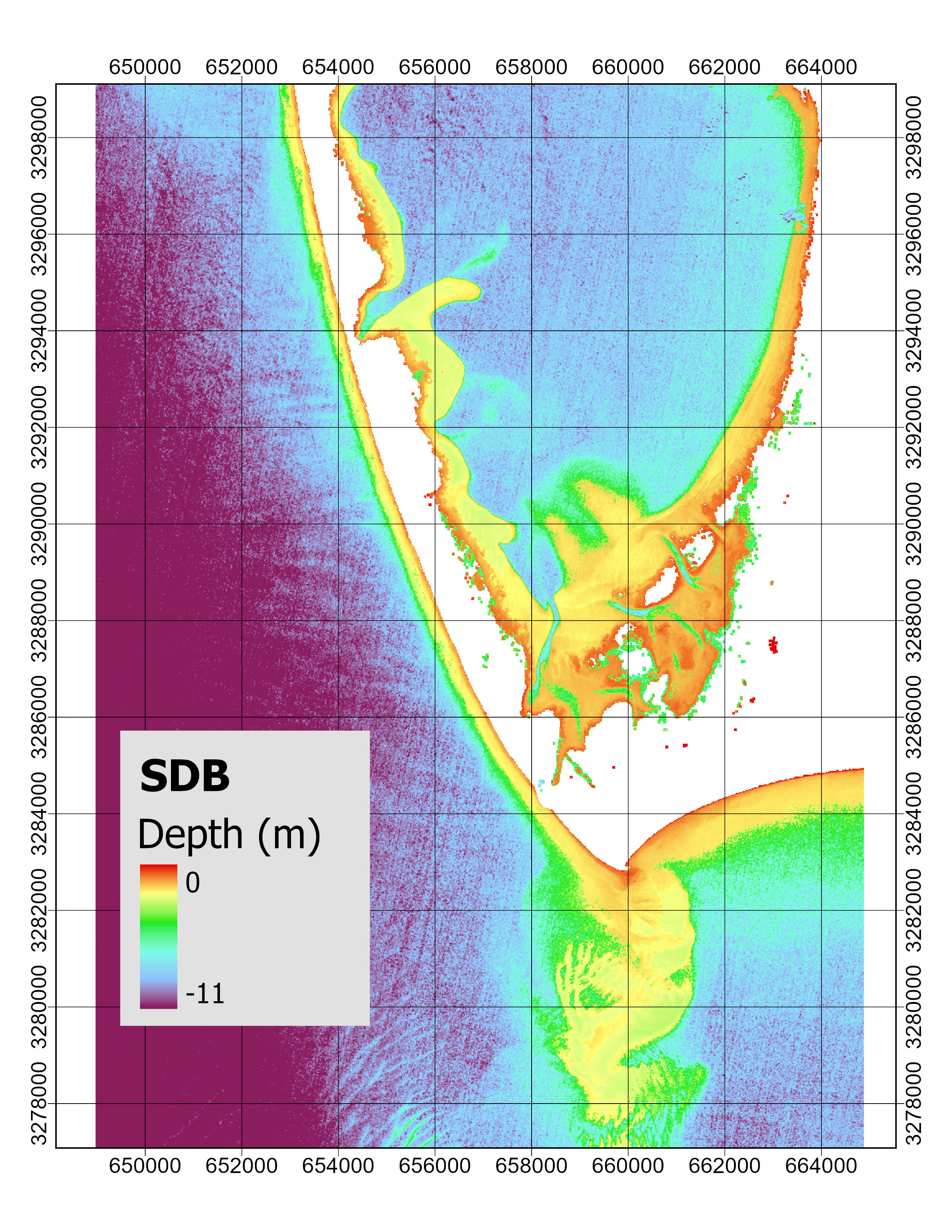
Bathymetric data can be obtained through conventional surveying methods, such as multibeam sonar or LiDAR. Satellite-derived bathymetry (SDB) provides a wide range of methods that allow the generation of bathymetric models from passive multispectral imagery. Conventional surveying methods have superior accuracy and spatial resolution, whereas SDB offers superior spatial and temporal coverage. SDB can be used to fill the gaps in data obtained from bathymetric surveys, or to generate bathymetric maps with the use of minimal field data. The suitability of SDB products for real life applications can be further assessed by understanding limitations in the methodology, and establishing clear guidelines on the use of SDB products. This study looks at some of the empirical methods used in SDB, which consist of modelling bathymetry from the linearized relationship between light reflectance and water depth. Two models were used in this study: the switching model and the two-class model. Each model consists of generating a bathymetric map using depths derived from two spectral band pairs. Both models use different methods to integrate preliminary depths into a final bathymetric map. The study area was set in St. Joseph Bay, Florida, using data covering two time periods: 2016 and 2020. The results showed some of the strengths and limitations of each model, as well as the discrepancies in modelled depth between two band pairs. Results highlight the improvement in accuracy from using more than one equation to model bathymetry across a scene, and a potential improvement in accuracy from using different band pairs across different depth ranges.