Modeling the Effects of Density Zoning on Racial/Ethnic Clustering in Oakland

Abstract
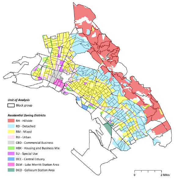
Land-use policies are the most likely way that local government can have an effect on residential segregation (Pendall, 2000). Density zoning can contribute to segregation by effectively prohibiting affordable housing from zones that exclusively permit large-lot single-family homes. Though there is a large body of research on the topic of residential segregation, studies modeling the effects of zoning on segregation are limited. With Oakland as the area of study, this research aims to a) examine racial/ethnic-based residential segregation using spatial clustering as a surrogate for segregated communities and b) test the impact of density zoning on the likelihood of racial/ethnic clustering using GIS and logistic regression. Each racial/ethnic group was found to be significantly clustered in the study area. The model results suggest that particular residential zoning districts are associated with the likelihood of racial/ethnic clustering. Clustering of Asian, Black and Hispanic populations were associated with a combination of zoning districts which permit a variety of densities, while clustering of White population was associated with only one zone, the single-family hillside district. The study uses a standard spatial measure of segregation, as well as a method which calculates zone presence within the unit of analysis. This research reaffirms the relationship between density zoning and segregation, expanding on previous studies by focusing on the clustering dimension of the segregation process.